El Capitan and Yosemite Falls

Alex and Maddie expressed interest in going backpacking this summer, so they joined Michael and I on a two-night trip down Yosemite Creek from Tioga Pass Road. Good water was a bit hard to find, but we did alright. The weather was wonderful, and we even had a neighborly “controlled burn” near camp.

It had been 30 years since my brother David and I had camped above Upper Yosemite Fall during one very warm and sunny Spring Break. David and I had a great time listening to Dr. Ruth Westheimer talk sex on our little AM/FM radio, and we also hiked out to the rim at night to see the Falls glow in the moonlight—to say nothing of lights down in the valley.

© 2013 Kaweah

South Rim 2013

This last weekend Michael and I headed to Yosemite for some day hiking. We had to abort the Upper Fall trail because I started to overheat and got light-headed. We then drove up to the Taft Point Trailhead and walked a loop from Sentinel Dome to Taft Point — a fabulous hike. Towards the end, Michael’s boots gave him trouble so he went barefoot.

© 2013 Kaweah

Vogelsang 2013

Michael’s first overnight backcountry trip, and we do it in style! We spent the first night at Tuolumne Meadows to acclimatize, and then headed up the JMT and then the trail to Vogelsang, Yosemite’s highest High Sierra Camp. Great food, good games, and careful with that wood stove if you don’t want to cook everyone in the tent cabin! It turns out I would have been more comfortable on the ground, but my own fault for overfeeding the thing.

© 2013 Kaweah

Diary of a Map Geek

I was born in California and raised in transit. In my parents’ fifty years of marriage, they have resided in forty different places in a half-dozen states and nations. My father is a restless man. He gives the term “blind ambition” new meaning: he is quite literally blind, and seems charged with a deep, innate pride. He lost most of his eyesight at age three, and then lost his eyes at age twenty. He doesn’t regret being blind, perhaps because he has achieved a great deal in his life that he might not have achieved had he been sighted. He has seen success after success as a chiropractor. As a wrestler from Mount Kisco, New York, he was once crowned state champion. They called him “King Kong of Kisco.” Blindness seemed to give him better body-awareness, and it sometimes distracted his opponents, though it was not quite enough to stop the national champ from pinning him at the national tournament in San Francisco.

My mother has also leapt some hurdles. A child of a Dust Bowl farmer, she fell victim to rickets (malnutrition) as a child, and grand mal seizures as an adult. Her tremendous will power has helped her to stabilize her blood sugar metabolism and avoid the seizures that once vexed her. Though she was timid and bereft of self-esteem as a young adult, she has since blossomed and shown herself to be a natural businesswoman with a particular knack for accounting. She and my father appear to have been made for each other, though she has never found a cure for his wanderlust.

Just after my first birthday, my family moved from south-central Los Angeles to Frogmore—a Gullah village on an island off the South Carolina coast, where my parents once attended a meeting of Martin Luther King and the Southern Christian Leadership Conference (SCLC). After Frogmore, we returned to California, and bounced around Santa Maria for several years. Then we returned to South Carolina, where my parents bought what had once been a boys’ home in a hamlet named Jericho. They’d planned to make the three-story hotel-of-sorts into a regional religious center, but the old building was a maintenance nightmare, and only served to impoverish them. Long before my parents ever managed to sell their “Hotel Jericho,” we moved across the low country into a small trackside house. There was no hope there to make a living, so we moved to the edge of a black neighborhood in nearby Walterboro, where I happened to attend a small Catholic school where I was the only non-black student. After that, we moved up near Greenville. A year later, nearly penniless, we returned to California and moved into a mobile home on the Mojave Desert near Lancaster, then moved to Hanford in the San Joaquin Valley, where business was always good. We did so well in Hanford that we moved to South Africa. That didn’t work out, so we returned to California and pitched our tents in Red Bluff. Next, we returned to South Carolina, and bought a house in Lancaster—our second hometown by that name. We soon went broke again and returned to California. We settled in Tulare, again in the San Joaquin Valley, and business was good—so good, in fact, that we returned to South Africa—well, almost: on the way to Africa, my little brother and I got jobs as security guards in Israel, but our parents went ahead and moved to Africa, and not for the last time, I might add.

Most of that moving was done either for missionary purposes or to finance further missionary work. All the motion left me a bit dizzy and not particularly rich in friends, but it was a valuable experience. It was an ongoing lesson in faith and financing, to say nothing of restlessness and alienation! It has informed my personal view of the world, which has always involved maps.

The maps began as the wallpaper of my childhood. There were the maps we used when moving across county, state, and country. There were the maps used to plan moves that we never made—Belize, British Columbia, etc. There were the maps used to plan missionary campaigns throughout the countryside. At age twelve, I began to explore the countryside on my own, with the help of a county map. Then I discovered the trove of maps at my local library and the libraries of the cities that we visited. I wrote chambers of commerce everywhere, and was rewarded with more maps. Maps became my personal window into the world.

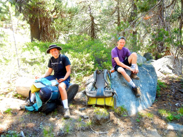
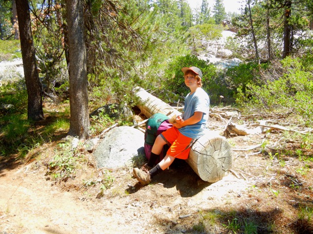
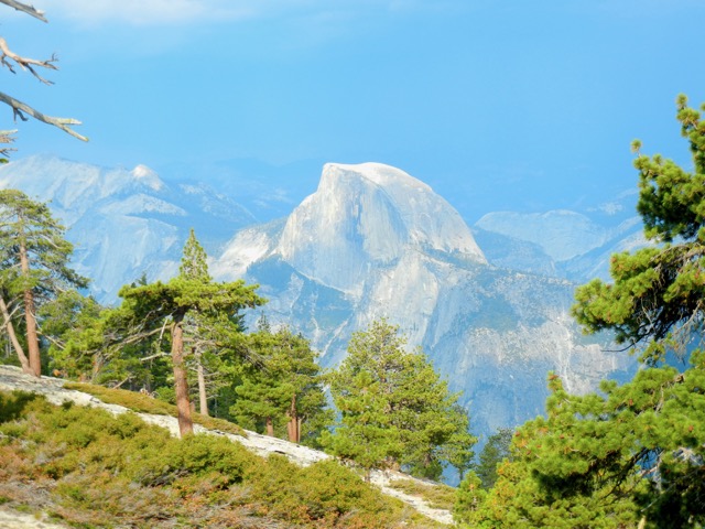
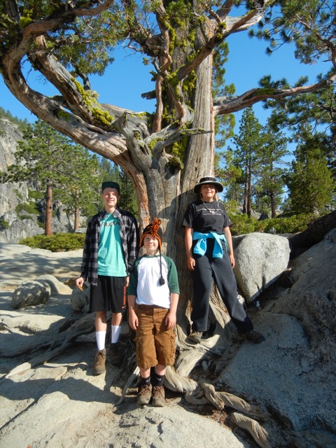
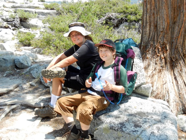
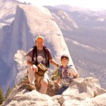
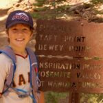
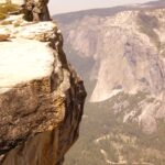
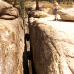
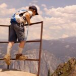
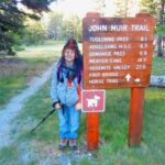
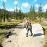
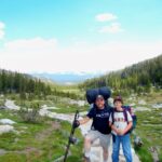
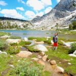
Maps present the world in a form that is at once abstraction and art. They showed me the world in a way that text and photos never could. They facilitate both exploration and imagination. It is in this capacity that maps introduced me to the Sierra Nevada. I can still see in my memory the images of maps that inspired my excursions into those mountains during my high school years.

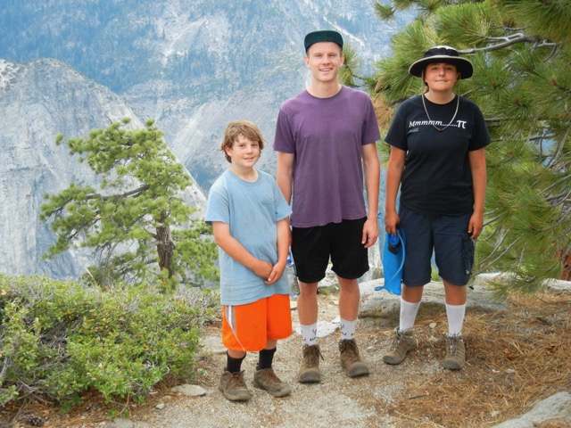
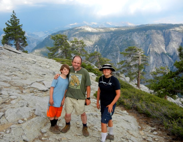
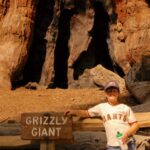
What I learned from the Sierra Nevada became part of me. With its giant sequoias, granite domes, golden trout, caverns, canyons, wildflowers and wildfires, dizzying heights, blue lakes, waterfalls, alpenglow and starry nights, the Sierra Nevada instilled in me a passion for nature and the natural sciences. The Sierra introduced me to earth science and astronomy, and by association, taught me to enjoy physics and mathematics. More recently, the Sierra has inspired me to study geophysics and plate tectonics, to understand the mechanisms that have forged the Sierra, California, and our planet. From what I have read, it seems that earth science and planetary science are in the midst of a golden, revolutionary age, and I’m off to join the revolution.

California v. II

… continued

Metamorphosis

About thirty million years ago, the trailing edge of the Farallon Plate began to disappear under North America in the shape of an inverted 90° wedge, beginning at the location of present-day Los Angeles, and proceeding northeast under the continent, leaving nothing but hot mantle where before was the cold, subducting oceanic plate.

Burial of the Farallon Plate

Burial of the Farallon Plate

Over the past twenty million years, that trailing edge has been crossing the Sierra Nevada region, and it’s traveled nearly as far north as Mount Lassen thus far, creating a great triangle between the trailing wings of the subducted Farallon Plate and the Pacific Plate.

With no more subduction to trigger the kind of volcanic activity characteristic of Mount Lassen and the Cascade Range to the north, the Sierra Nevada has transitioned into a new phase of plutonic activity. The hot, underlying mantle has pressed up through the great triangle, causing uplift and, as the uplifted dome has increased the surface area above, spreading. The spreading, in turn, has created grabens such as Owens Valley.

Though the stone that makes the Sierra Nevada was formed long before this uplift and spreading, it was this event, beginning about thirty million years ago, that actually gave rise to the Sierra Nevada that we know today. Still, there have been much more recent events that have contributed greatly to the general, large-scale structure of the range.

A New Age of Volcanism

This new incarnation of California lacks the Cascadian volcanism of its past, yet the existence of the eruption of the Long Valley supervolcano 760,000 years ago attests to the volatility of the present-day Sierra Nevada. It was an eruption 500 times the size of the 1980 Mt. St. Helens eruption and 30 times the size of the 1883 Krakatoa eruption, surpassed by only four eruptions over the last million years:

  1. Lake Toba, Sumatra, Indonesia
  2. Whakamaru, North Island, New Zealand
  3. Lake Taupo, North Island, New Zealand
  4. Yellowstone Caldera, Wyoming, USA

There are no stratovolcanoes along the spine of the Sierra Nevada, but there is evidence of something more terrible.

Localized Foundering of the Farallon Plate

As the trailing edge of the cold, dense Farallon Plate was detached from the supporting mass of any trailing oceanic plate, that trailing edge must have begun to sink — not merely as a caboose follows a train downhill, but rather more directly down, as it was no longer supported on its western boundary.

Delamination and Mantle Drip

Such a sinking mass must have pulled on the lithosphere above it, and possibly pulled the dense root of the Sierra Nevada downward and away from the mountain range. Once the trailing edge of the subducted plate passed, the detached root of the Sierra — being relatively dense — may have begun to sink more directly into the depths of the mantle, causing local downwelling.

Subsidence east of Fresno

Sinking mountains east of Fresno

Asthenospheric mantle flowed in to fill the gap where the Sierra’s root had been — probably liquefying under reduced pressure, and the Sierra, without the ballast of its dense root, became more buoyant, and began to rise, pulling even more asthenospheric mantle up with it, some of which would have liquefied. As magma, it would have injected itself into cracks in and around the thin Sierra block, ushering in the current phase of Sierra volcanism.

As the delaminated Sierra root descends into Earth’s mantle, it has created a local convection cell. The sinking root is causing downwelling in its wake, and pushing mantle rock downward and outward ahead of it. This downdraft appears to be causing subsidence in the Tulare Basin and the western Sierra adjacent to the basin.

As the displaced mantle rock is pushed aside, it then begins to rise, creating upward pressure at its edges — probably more along one edge, due to asymmetry. The upward pressure creates a local updraft, which may be adding to the uplift of the Sierra.

Further Reading:

Active foundering of a continental arc root beneath the southern Sierra Nevada in California

Watching Whales in the Sink

California v. I

It’s common knowledge that water is the bane of fire, but the Earth tells us a different tale.

The continents of Pangaea

The continents of Pangaea

Up to about 200 million years ago, at the dawn of the Jurassic Period, there was no California. It might be said that even North America didn’t exist. North America had then part of the supercontinent of Pangaea, which was about to break apart.

As ancient peoples once imagined their world an island in a great sea, so Pangaea was an island in a great sea. For eons, the rivers of Pangaea carried sediments to that sea, loading down the dense, cool crust beneath the waters. That crust, it turn, was floating upon an ocean of lithospheric mantle, but the crust was getting heavier and losing its buoyancy, until finally it gave way, and began to list like a ship giving in to the sea.

Around Pangaea, ocean floors began to dive beneath it for the same reason, leading to what we know today as the Pacific Ring of Fire, and the Triassic supercontinent began to fracture under the strain of the spreading triggered by the suction of ocean floor subducting into its perimeter.

Here on the eastern shore of the great ocean, the Farallon Plate was born out of the disintegration of Pangaea. As this young oceanic plate dove under Pangaea (and later Laurasia), the uppermost layer of the plate was scraped off and piled against the edge of the continent, and so Cascadia was born. Cascadia is that land commonly known today as the Pacific Northwest. When California was young, it was part of Cascadia.

The continent was pulled westward and stretched along its margin, giving rise to the forearc basins known today as the Puget Sound, the Willamette Valley of Oregon, and California’s Central Valley.

The water-loaded serpentine hydrated the rock beneath the continent, liquefying the rock and causing streams of melt to form. This led to the formation of a volcanic arc along the Pacific Coast, and deep below, the plutons that would eventually uplift to become the Sierra Nevada and Klamath Mountains of the present.

The hydrated magma streams that feed the volcanoes of Cascadia are not pacified by their water continent, but contrarily, rendered all the more volatile by the resulting steam, making for explosive releases of subterranean fire, not unlike the sudden expansion of a grease fire when fed with water.

Down in Cascadian California, there was no San Andreas Fault, nor any great granitic Sierra Nevada. These and other characteristic features of present-day California would arise as the trailing edge of the Farallon Plate began to disappear under North America.

To be continued …

Kern Canyon 2008: Friday

This last full moon, I backpacked up to the Kern Canyon stock bridge in Sequoia National Park. I started at Lewis Camp Trailhead, in Sequoia National Monument, just outside the southern boundary of the Golden Trout Wilderness. This trailhead sits near the top of the Western Divide, on the historic Jordan Trail. For many trips that begin there, the trailhead is the highest point of the trip (7600 feet).

Tulare County SAR Jeep

Tulare County Sheriff SAR Jeep

I pulled into the part of the dirt lot reserved for foot-bound travelers and parked, only to be directed by a Sheriff’s deputy to another spot, to make room for the SAR (search and rescue) workers expected to arrive soon. There was already quite a showing of force: a trailer, a jeep, a couple ATVs, and several other vehicles. Word had it that a man who had been suffering from seizures was lost on the nearby slopes.

About 15 minutes down the trail, I realized that I’d left my wilderness and fire permits in the car. That seemed rather ironic, after having driven four hours to get to the ranger station just before closing time, only to leave the permits in the car. Oh well. Never fails. I always forget something. I decided to take my chances with the rangerfolk, rather than add 30 minutes to my evening hike.

I few minutes later, I encountered a group of cattle, who spooked with no more than a mutual glance, and kicked up a cloud of dust in their panic.

I bounded down the 1900 foot descent, past Jerky Meadow and Jug Spring (a watering hole for animals and the desperate), and arrived at the Little Kern horse bridge just after 8pm, with an hour of dusk to spare. I suffered from a typical spell of outback anxiety along the way, which means I missed my wife and kids terribly and felt guilty about being so selfish as to take this time to myself. Perhaps the evening shadows settling over the mountainside were affecting me. There is something ominous about the onset of nightfall when one has not reached one’s destination, though the night itself can seem quite comforting. Almost predictably, the anxiety disappeared as I settled in for the night.

Horse Bridge across the Little Kern
The bridge over the Little Kern. Note the granite and basalt layers.

Two of the three campsites were occupied by SAR folk, so my choice was easy. I filtered some river water, had some trail mix for dinner, and unrolled my sleeping bag. I enjoyed the warm light of the fire at the camp across the river, laid back, and watched the stars appear one by one.

Antares—the heart of the Scorpion—flared red, like a campfire in the sky, not so remote as the astronomers calculate. I spotted a falling star, and watched a dim, red satellite make its way around and around the planet, first past Lyra toward the pole, then past Cygnus a little while later. Jupiter peeked through the ridgetop trees across the river. The full moon didn’t rise over the tail of the Great Western Divide until I had fallen asleep. I would waken occasionally, as see the Moon chasing Jupiter from west to east.

A full moon can be useful if one needs to get around camp without a light, or if one needs to travel by night, but it can disturb one’s sleep, rather like leaving the bedroom light on, and a moonless sky is certainly preferred by the stars.

Continue to Saturday

Sisters of the Sierra

One special characteristic of the Sierra Nevada is that it’s a rare example of a high mountain range in a Mediterranean climate, which means that it is dry and sunny half the year and moist and mild during the other half of the year. This combination makes for a very combustible cycle of fuel production and fuel dehydration.

I’ve been looking for sister ranges of the Sierra Nevada; that is, other igneous ranges. What this means is that I’m looking for well-forested mountain ranges in Mediterranean climes. This generally means high mountain ranges, because altitude generally means two things: (1) orographic precipitation for production and (2) orographic lightning for combustion.

You’d think that the Andes where they cross the Zona Central of Chile would be an ideal example, but the Andes are rather sparsely forested in the northern half of the Zona Central, perhaps because the Andes are too lofty to the north for extensive forestation. South of here, in the Maule district (VII) and even more in the Biobio North district (VIII), there is more forest, but there is also more precipitation. Rain is in fact so common that it’s hard to call the climate Mediterranean. There is really no time of year that is truly dry in the southern half of the Zona Central; not, at least, as dry as most of California is in Summer.

There aren’t very many other choices, as far as I am aware. There are many lower Mediterranean ranges, and several high ranges near to Mediterranean climes, but not many high ranges are in Mediterranean climates.

The only others I know of are in Iran: the Alborz, Zagros, and Sabalan mountains. None of these is heavily forested, but in the case of Iran we can be quite confident that they were once more forested than they are today.

At present, though, I can think of no mountain range in the world that shares with the Sierra Nevada this Mediterranean annual cycle of production and combustion at a comparable scale.

What is California?

California Districts

An enumeration of the elements of California might proceed as follows:

  1. The San Andreas Fault
  2. The California Current
  3. The Sierra Nevada
  4. The Central Valley
  5. Redwood Forests

The San Andreas Fault

The Pacific and North American Plates, two of the world’s largest, collide from the Gulf of California to Shelter Cove, just south of Cape Mendocino, California. This collision, roughly delineated by the San Andreas Fault, is what put the place we call California on the map.

The California Current

California is probably best known for its climate, a phenomenon which owes no small sum to the fact that California is a collision between continental and oceanic plates, with two particular circumstances:

  1. The collision has a north-south orientation, with cool ocean currents flowing from the north.
  2. The collision occurs across a broad spectrum of tropical, subtropical, and temperate latitudes, from 23 to 40 degrees north.

All this adds up to a mild, sunny climate. Add to that an occasional quake to keep everybody on their toes, and you have the California of the Padres.

The Sierra Nevada

Another California was born in 1848, not of sunshine and mild weather, but of greed. That rebirth was initiated and sustained by four gifts of the Sierra Nevada:

  1. gold
  2. water
  3. soil
  4. beauty and recreation

The massive Sierra Nevada traps large volumes of atmospheric moisture, leaving the lands to the east dry. It being a large mountain block, much of that moisture is stored as snow and ice, meaning that the moisture is released when it is needed most, during the warm, dry springs and summers. As that moisture is released, it carries with it the sediments that become the soils of the great Central Valley.

As lady luck would have it, a smattering of that sediment is gold. It was the glitter of gold in Sierra streams that set the tone for the future of California and America, just as that glitter brought the world to California before her greatest riches were discovered. Beyond the extravagance of gold and the practical benefit of water and soil, we must not forget the beauty and recreational value of Lake Tahoe, Yosemite, the High Sierra, and the Giant Sequoia (more on that to come).

The Central Valley

Without Sierra Nevada sediments, much of the Central Valley might be known today as the Central Sea, like the Sea of Cortes (the Gulf of California) to the south, but the Sierra Nevada does not entirely account for the Central land form of California, be it land or sea, and there are other mountains that feed the Central Valley. The Sacramento River is proof of that. The Sacramento River is fed by the southern end of the Cascade Range on east, and the Trinity Mountains and other ranges on the west.

Redwood Forests

“From the redwood forests to the Gulf Stream waters, this land was made for you and me.” — Woodie Guthrie

Another natural resource that plays a central role in the California myth is the California redwood tree, which lives along the western slopes of the Sierra Nevada and the Pacific Coast, from Big Sur the far southern Oregon.

Where is California?

Having taken all these elements of California into account, a natural eastern boundary of California can be seen to proceed along the following features:

  1. The east coast of Baja California.
  2. The Colorado River.
  3. The crest of the Chocolate Mountains (just east of the San Andreas Fault).
  4. The crest of the Little San Bernardino Mountains.
  5. The crest of the San Bernardino Mountains.
  6. The crest of the San Gabriel Mountains.
  7. The crest of the Tehachapi Mountains.
  8. The eastern edge of the Sierra Nevada.
  9. The eastern edge of the Cascade Range. The boundary continues northward here to include the watershed of the Sacramento Valley.
  10. The crest of the Siskiyou Mountains.
  11. The northern boundary of the Smith River watershed. This is the approximate northern boundary of the region called “the Redwood Empire”.


California As Collision

Along the northeastern shore of the Great Ocean, a long, thin strip of land stretches 1500 miles, in about as straight a line as Nature will allow Herself to draw. The strip is born of the grinding of the great oceanic plate against the continental plate.

From Cabo San Lucas to Cape Mendocino, California is characterized by a system of strike-slip faults between the Pacific and North American plates, but California is more than a mere side-swipe; it is a collision, and this intercontinental collision involves—like so many others—one continent wedging under the other. In this head-on component of the collision vector is born the Sierra Nevada.

The uplift of the Sierra Nevada has not been gentle. It was associated with one of the most powerful earthquakes in California history, the Great Lone Pine Earthquake. It has also been associated with one of the most fantastic volcanic events known to science: the Long Valley supervolcano.