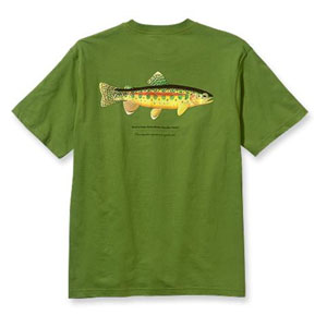
At Tunnel or “Chickenfoot” junction we enter the domain of a slightly different subspecies of golden trout native to the South Fork Kern. This junction was once known as the turnoff to Mount Whitney, but today it is better known as the boundary of two very special watersheds; a boundary that was once infamously compromised to favor one farming community over another.
In 1886, Chinese laborers dug a tunnel between the South Fork and Golden Trout Creek to divert water to the former. One account has it that the tunnel was soon dynamited by the constituency of the latter party.
“This narrow, stream-bordered dike is the great landmark for all Whitney travelers, as here the Whitney trail leaves the Hockett. This hranching place is again indicated by a tunnel under the dike which transfers the northern stream almost wholly into the southern. The traveler approaching the forks (Tunnel forks) from either direction will notice the sudden increase in volume of the southerly stream.” — Hubert Dyer, Sierra Club Bulletin, 1893
This is the starting point of two fishing trips: one up Golden Trout Creek, on the Siberian Pass Trail, and another down the South Fork Kern River, on the Ramshaw Trail. Add to those trips Golden Trout Creek as it flows down to Kern Canyon and the upstream South Fork, and Tunnel begins to look like a great base camp.
Once you’ve got your fill of this great golden trout junction, proceed east on the Trail Pass Trail, along the north edge of Tunnel Meadow. Look for a corral about midway, then an abandoned airstrip, which we might call Tunnel International Airport, toward the far eastern end of the meadow.
“THROUGH COOPERATION, Sierra Air ways offers those of our patrons who wish to save time, fast transportation by air, thirty minutes from Lone Pine to our new camp, located in the heart of the Sierra at Tunnel landing field. Tunnel field is the highest airport in the northern hemisphere-elevation, 9,200 feet.” — Chrysler and Cook Pamphlet
The trail then follows the brook that will develop into the South Fork downstream. It may not seem like much at this point, but look again: spot the golden glistening of its native trout?
Eventually the trail pops over a gap and descends into BullFrog Meadow, and finally the cattle pastures of Mulkey Meadow, before ascending northeast toward Trail Pass, the highest point on the Hockett Trail.
Contrary to some popular accounts, the Hockett Trail did not cross the divide at Cottonwood Pass. The route over Trail Pass is shorter, easier, and much better documented among early accounts.
“The trail over Mulkey Pass is the shortest, most direct route which may be taken to reach this famous hunting area, although it may also be reached over Cottonwood Pass.” — Chrysler and Cook Pamphlet
More evidence: the Mount Whitney Trail began at Tunnel junction. If the Hockett Trail had climbed over Cottonwood Pass, there would have been no need for the Mount Whitney Trail to go so far south.
“From the summit of the watershed the trail traverses the famous Mulkey Meadows, named after a widely-known Sheriff of early days, and soon strikes the trickling source of the south fork of Kern river. It clings closely to its northern bank for a few miles and then comes out upon a narrow tongue of land, apparently a moraine, lying between two streams, branches of the south and north forks of the Kern, not more than three hundred feet apart.” — Hubert Dyer, Sierra Club Bulletin, 1893
See Exploring the Southern Sierra: East Side by Jenkins & Jenkins: Horseshoe Meadow to Kern River Backpack (T114) and Saddles, Ridges, Passes, and Kern Peak Backpack (T115). Also see Hiking California’s Golden Trout Wilderness by Suzanne Swedo: Tunnel Meadow (30) and Kern Peak (32).
