

For a moment, I’d like to duck out of the downpour of ignobility and brutality that is Amerisrael and slip into the shelter of boyhood fantasies. From about the time I got my first bicycle, I began to spend a great deal of time with maps. They were for me a portal to exotic places, whether that be a farm town ten miles down the road or a mountain stream on the other side of the planet.
Chile
Today I’d like to travel to the Mediterranean mirror-image of my native California, central Chile, by means of several world atlases within reach. I know that modern digital mapping is much more useful than this old tech, but humor me. I love this stuff!
Mediterranean Chile can be said to extend from the resort town Zapallar in the north to Temuco in the south. To simplify a bit, one can envision this zone being sandwiched between the great Atacama Desert in the north and Patagonia (famous for its fashionable outdoor wear — JK) in the south. Most of Chile’s larger cities are in this region. The only Chilean city over 250,000 outside of this zone is Antofagasta in the arid north.
I’ll begin with the National Geographic Atlas of the World (in my case the 7th Edition which my sister gave me). This is a beautiful and detailed atlas. The fact that National Geographic (NG) doesn’t code elevation with colored backgrounds makes the text readily readable. National Geographic plates cross the binding crease without interruption. This is visually satisfying, and the manner of binding makes it technically effective: the dip is shallow and the names caught between pages are legible.
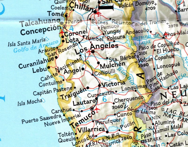
This atlas does have its shortcomings. It sells South America a bit short, covering the continent with only three plates (shouldn’t an American atlas do better?) The plate that covers the southern cone of South America has a scale nearly small enough (~1:7M) to include the entire length of Chile, but not quite: it excludes the country’s northern tip. Odd choice.
Let’s introduce the Times Comprehensive Atlas of the World (12th Edition) for comparison. This atlas provides twice as many plates of South America, with five 1:5.5M plates, plus one 1:2.75M plate featuring southeastern Brazil. To compare, the three South American plates in the NG atlas range in scale from 1:6.9M to 1:7.7M.
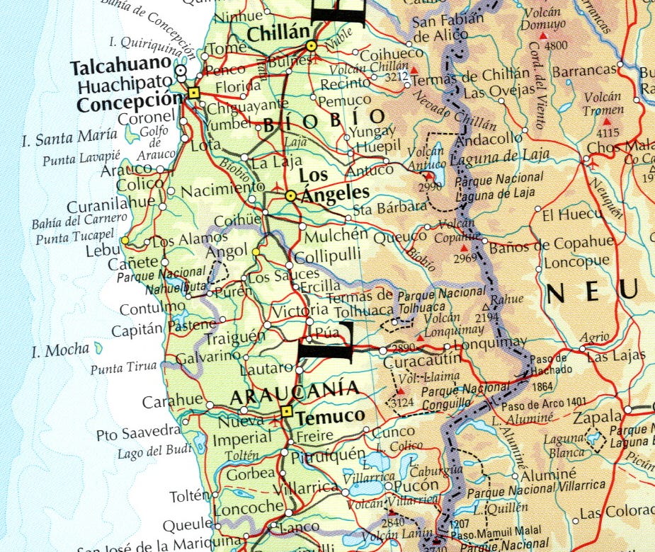
Small scale tends to result in a lack of information. The NG atlas includes six Andes peaks from Cerro del Planchón (east of Talca) to Volcán Llaima (east of Temuco). In contrast, the Times atlas includes 14 peaks in that segment of the Andes. The Times atlas includes seven national parks in the same area; the NG atlas includes only three. The Times atlas indicates the approximate size of cities by symbol; the NG atlas only does so by font size.
Looking at the Bío Bío region of Chile, I see that the NG atlas indicates about 27 cities and towns; the Times atlas indicates about 41.
The NG atlas is easier to read, but again, the Times atlas provides more information about elevation. I can see from the Times atlas that much of the Andes east of Temuco is over 3,000 meters, whereas I see that south of Temuco there are fewer areas over 3,000 meters. I can guess this from the peaks and passes indicated in the NG atlas, but the color-coding provided by the Times atlas gives me a higher confidence level.
The Times atlas also distinguishes between volcanos and other peaks, though I’m inclined to think this distinction is rather dubious in the Andes.
There are exceptions to these stated advantages of the Times atlas. The passes Paso de Pino Hachado (1864m) and Paso del Arco (1401m) can be seen to the east of Temuco in both atlases, but the Times atlas gets the names of both passes wrong (drops the word “Pino”) and replaces (“del” with “de”), and the text is harder to read. Also, the NG atlas icludes one more pass in this segment of the Andes than the Times atlas does.
I have a low-confidence impression that National Geographic’s atlas is less error-prone, but I have identified inaccuracies in both atlases.
Looking at the town of Nueva Imperial on the Cholchol River, west of Temuco, I would judge that the NG atlas gets the town’s location wrong, though not by much. Likewise, the Times atlas positions the mountain town of Lonquimay more accurately than the NG atlas does.
By going a bit into the past we can look at the last edition of the out-of-print Rand McNally Cosmopolitan (RMC) Atlas. This is a smaller, more affordable atlas, yet is compares well. It provides two 1:12M plates for full coverage of South America, but adds four large-scale (1:6M) plates as well. That’s a larger scale than anything offered for South America in the NG atlas!
How do the Rand McNally 1:6M plates cover central Chile? They go as far south as Temuco. They do include a number of peaks, but they include no passes in the segment of the Andes that we are inspecting. There is no indication of national parks or airports, but considering the more compact size of this atlas, its coverage is impressive.
Iran
Seeing as I was born and raised in an Iranian religion, I retain some interest in Iran and Afghanistan, my interest in the latter being due to my sustained interest in Zoroastrianism.
NG’s coverage of Iran is rather embarrassing. The entirety of Iran is covered at 1:7M, but western Iran is at least covered at 1:4.4M. The Times atlas, in contrast, covers the entirety of Iran at 1:5M, with portions of southwestern and western Iran. covered at 1:2.5M and 1:3M; significantly better. The RMC atlas displays Iran at 1:6M scale, which again is good considering the modest size of the book.
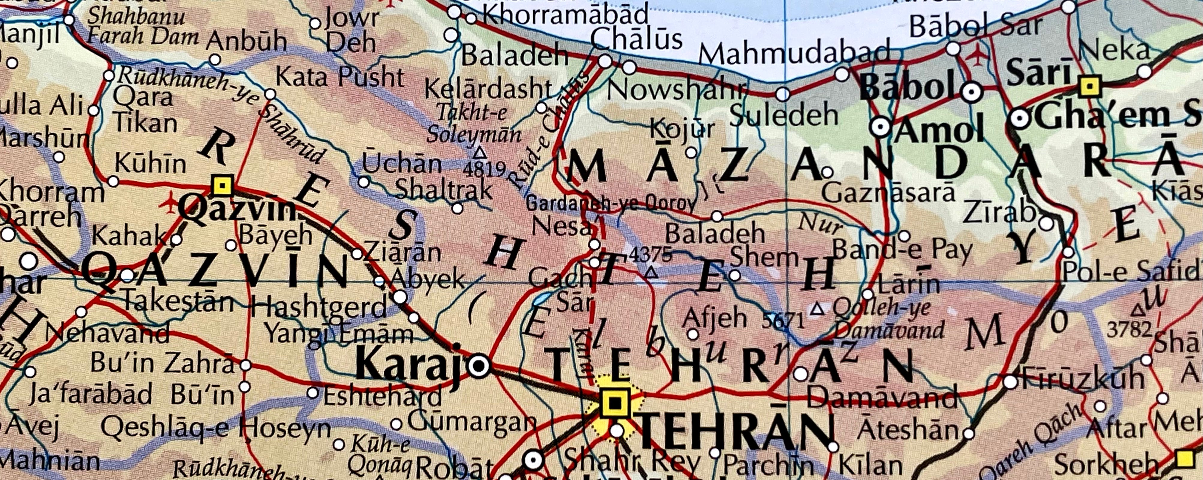
Let’s get down to examples. What can we find in the area of the ancestral home, or summer home, of the founder of the Bahá’í Faith? The Times atlas includes the Nur River, which is the stream that flows by the summer home of Bahá’u’lláh’s father. The NG and RM atlases do not label the Nur River but they do indicate the path of the stream.
Both NG and Times atlases include Bísotún, site of the famous inscriptions, but the RMC atlas does not. The Times atlas also includes nearby Kúh-e-Paráú (3393m), site of what is reported to be the highest cave in the world and the deepest cave in Asia. The other two atlases do not include this peak.
The Times and RMC atlases indicate the internal boundaries of Iran. The NG atlas does not. That’s a significant shortcoming.
Afghanistan
The atlases under review provide maps of Afghanistan at the following scales:
The Times: 1:5M
National Geographic (NG) 1:7M
Rand McNally Cosmopolitan (RMC) 1:6M
The town of Bamyan, location of the Buddha statues demolished by the Taliban, has major passes to its east and west, both of which are represented in the Times atlas:
Níl Kowtal (Níl Pass) (3538m)
Kowtal-e Shíbar (Shíbar Pass)
The NG atlas includes “Kowtal-e Shebar”; The RM atlas includes neither pass.
The Panj river (the main river of Badakhshan) is labeled in the Times and RMC atlases; not in the NG atlas.
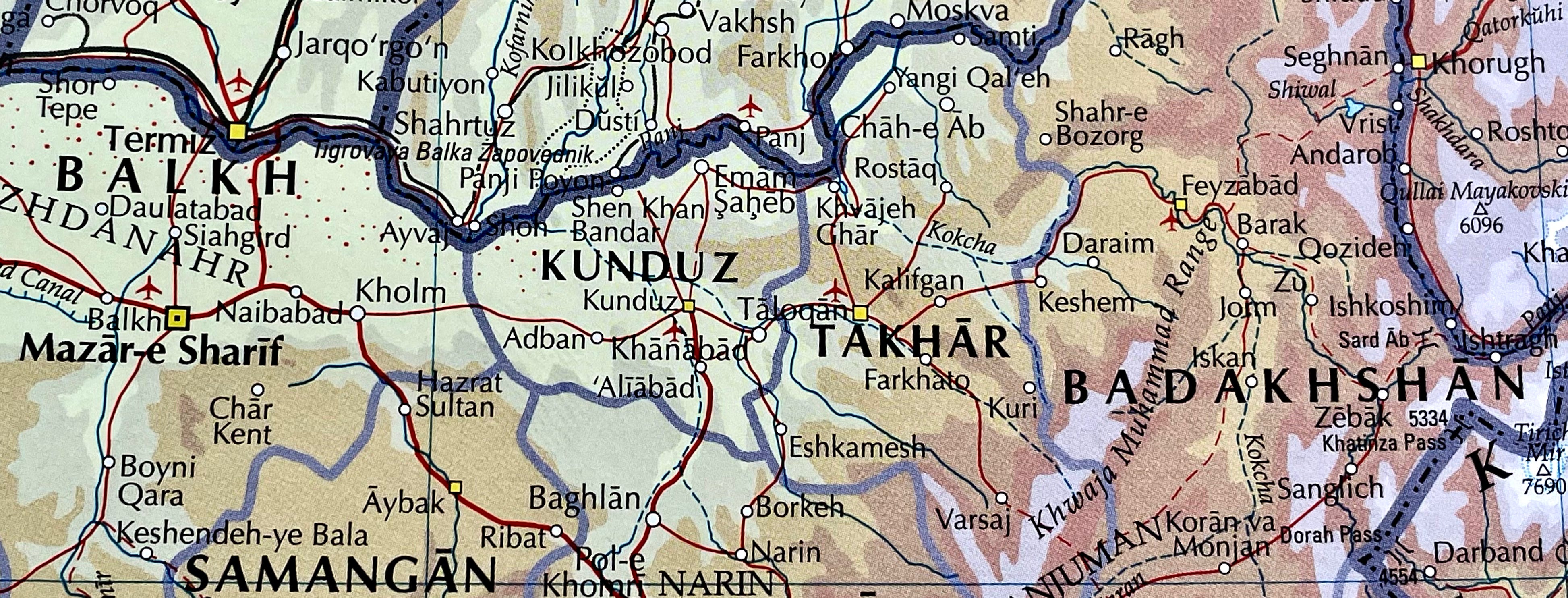
The Kokcha River, a tributary of the Panj famous for its Sar-i Sang lapis lazuli mines, is labeled only in the Times atlas, though its course is indicated in all three atlases.
Dorah Pass, a high pass between Afghanistan and Pakistan, is included only in the Times atlas.
The village of Ragh in Badakhshan which might be associated with early Zoroastrianism is included only in the Times atlas.
The Times and RMC atlases indicate the internal boundaries of Afghanistan. The NG atlas does not.
These examples establish the Times atlas provides the best coverage of Afghanistan. The NG atlas might provide coverage that is inferior even to the more modest RMC atlas.
Denmark
My interest in Danish geography is mostly genealogical. That interest is well served by the 1:1M scale plate of Denmark and southern Sweden provided by the Times atlas. Among the obscure details that the Times atlas exclusively provides are Ugelbølle (the birthplace of my great-grandfather), Lime (the birthplace of his wife), Gjesing, and Ørum. All this is a bit unfair, as no world atlas need provide such scale for Denmark, but I appreciate it nonetheless. The scale provided by the NG atlas (1:1.3M) is nearly as excessive.
California
The NG atlas ought to win the prize for coverage of California, and perhaps it does. It provides a dedicated 1:2M-scale plate for California that is hard to beat. The Times atlas covers California with two 1:2.5M-scale frames, however it adds two 1:1M-scale regional maps of Southern California and Northern California that might be slightly lacking in detail. That said, the coverage of the Bay Area and the Central Coast is excellent, even including exclusives such as Tassajara Hot Springs, Jamesburg, Coyote, Coyote Creek, Carmel River, South Ventana Cone, and Carmel Point. Unfortunately, it places Carmel Point on Highway 1; not far off the mark but rather conspicuously wrong to a local. Notwithstanding such an error, this is great Cali-coverage for an atlas made by Brits.
Conclusion
I love both the Times Comprehensive Atlas of the World and the National Geographic Atlas of the World. Both are works of art and portals for the imagination. As a boy these heavy volumes were strictly reference. I don’t think I ever imagined as a young map addict that they could even be purchased by mere mortal non-librarians. Opening them up and daydreaming takes me back to that time.
There is one atlas that I have not mentioned: The Rand McNally New International Atlas. That monstrosity has been out of print for over thirty years, but I think it’s worth putting up against the Times Comprehensive Atlas of the World. I look forward to doing that soon.